

Seat
The highest mountain pass in the High Tatras accessible to hikers



Length of a one-way route
Exposed high-altitude sections
Estimated walking time
Across the highest mountain pass in the Tatra Mountains accessible to hikers
This challenging all-day hike leads from Hrebienok past the Obrovský Waterfall, Zamkovský Chalet, and Téry Chalet to the high-altitude Sedielko. The route passes through the Malá Studená Valley, around the Five Spiš Lakes and Modré Lake, all the way to the highest pass accessible to hikers in the High Tatras.
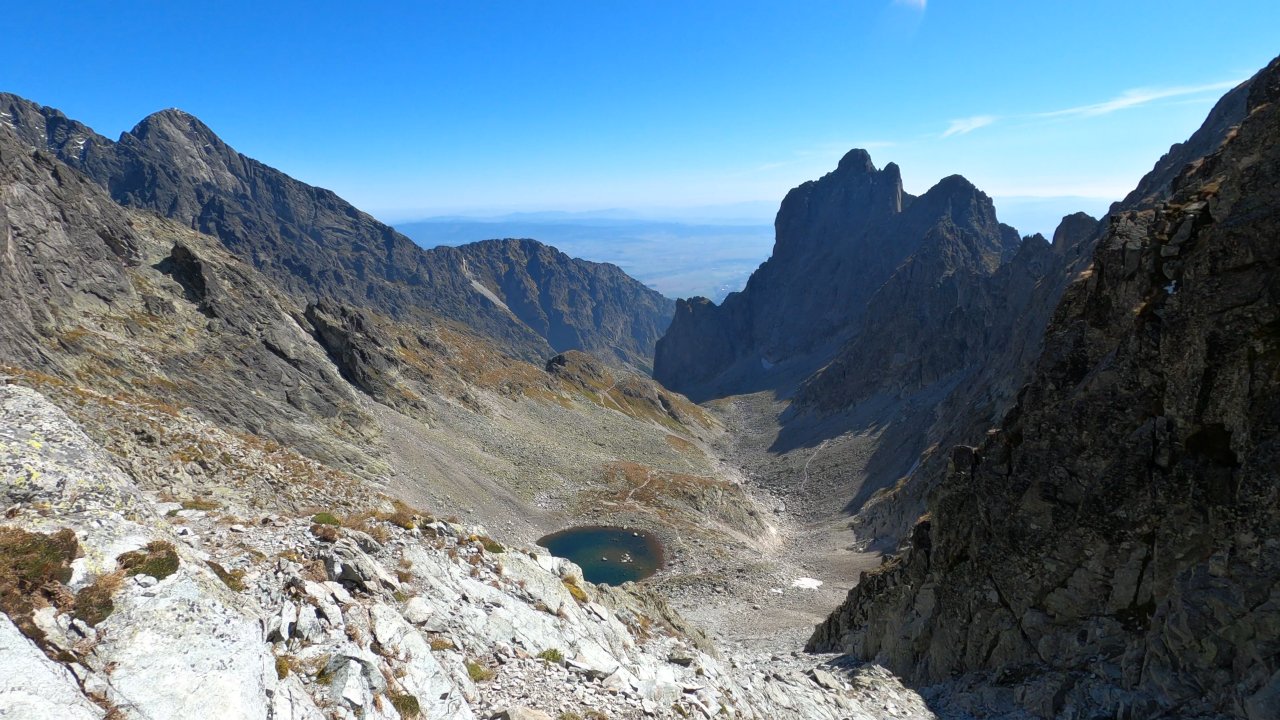
From Sedielko, views open up toward the Malá Studená and Zadná Javorová valleys. Beyond the pass, a long descent follows along Žabé Javorové Lake through the Javorová Valley down to Tatranská Javorina. Exposed sections are secured with chains and climbing rungs.
What can you experience and see along the route?

What do you need to know before you arrive?
Please read this before your visit
The high-altitude sections passing through Sedielko are closed seasonally from November 1 through May 31. Always check the current conditions and whether the trail is passable before setting out on a hike.
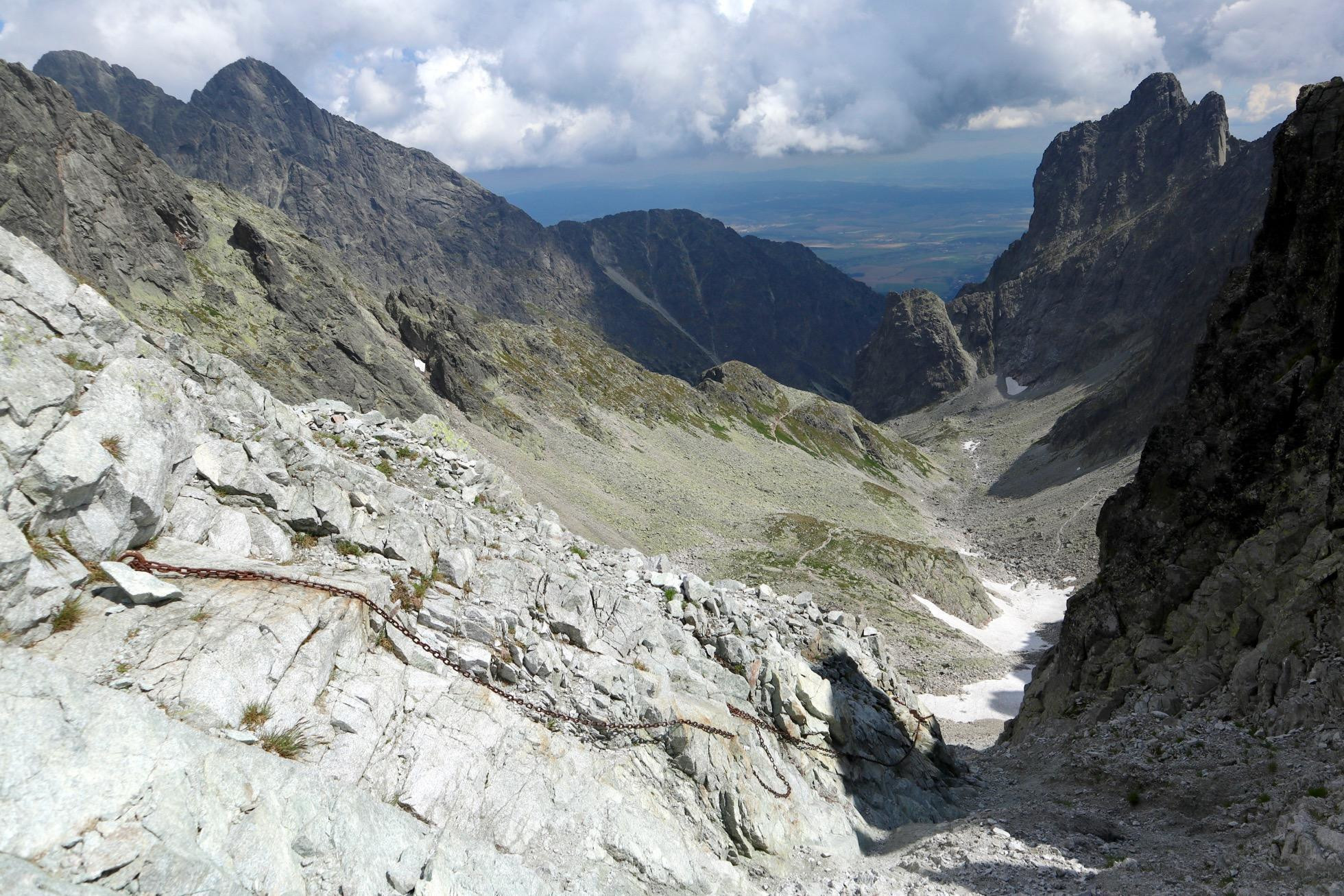
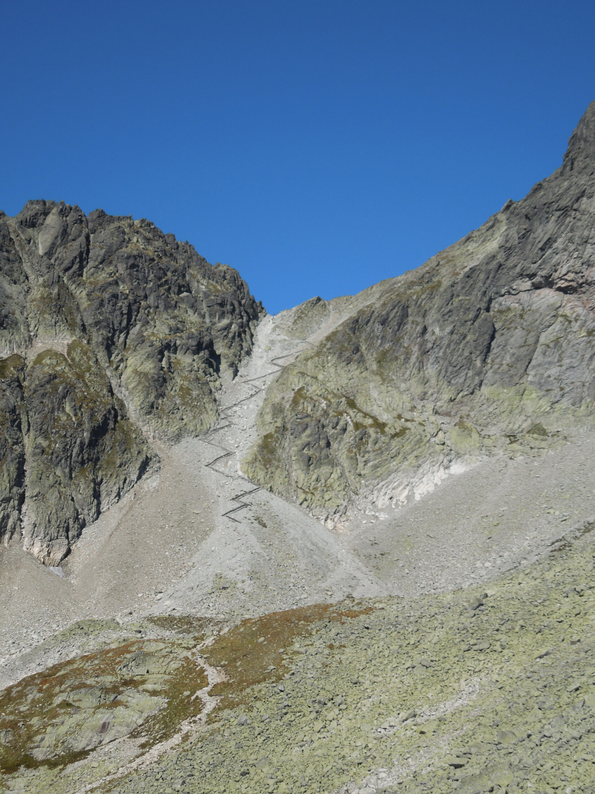
The final ascent to Sedielko and the sections beyond the saddle lead through exposed rocky terrain. The trail is secured with chains and climbing rungs; nevertheless, it is not suitable for people with a fear of heights or inexperienced hikers.
The stated distance of approximately 21 km and the estimated time of about 8 hours and 50 minutes refer to the hike from Hrebienok to Tatranská Javorina without any extended breaks. You’ll need to add the travel time from Starý Smokovec to Hrebienok to this total.
From Hrebienok, the trail follows the red hiking trail through the junction above Rainerova Chata and past Obrovský Waterfall to Zamkovského Chata. From there, it continues along the green trail through Malá Studená Valley to Téryho Chata.
From the mountain hut, the trail leads past the Five Spiš Lakes toward Modré Pleso and the crossroads below Sedielko. The final ascent involves steep, rocky terrain secured with chains and rungs. The highest point of the hike is Sedielko at an elevation of 2,376 meters above sea level.
From the saddle, the trail descends through the Zadná Javorová Valley, passing by Žabé Javorové Lake. It then continues through the Dlhá Javorová Valley, past the Pod Muráňom junction, all the way to Tatranská Javorina.
Route Markings
Red Mark
Hrebienok – Crossroads above Rainerova Chata – Obrovský Waterfall – Crossroads near Zamkovského Chata
Green Mark
Zamkovský Hut – Téry Hut – Crossroads below Sedielko – Sedielko – Pod Muráňom – Tatranská Javorina
Return
From Tatranská Javorina, take the bus toward Starý Smokovec according to the current schedule

Tak to u nás vyzerá. Pozrite sa

High-Altitude Hiking in the High Tatras
Challenging climbs to the Tatra peaks, exposed ridges, and views that reward every strenuous step—discover trails for experienced hikers seeking a true mountain challenge.




Must-See Places. Discover them one by one
Every corner of the Tatra Mountains has its own story. Discover the places that shape the character of the region.







The Tatra Mountains wake up differently every day
Current conditions, upcoming events, and editorial recommendations. Everything you need to know before heading to the Tatras.

Webcams
Poprad
0°C
Mostly clear

Lomnický štít
-10°C
Mostly clear
Tatranská Lomnica
-2°C
Mostly clear
Starý Smokovec
0°C
Mostly clear
Hrebienok
-1°C
Mostly clear
Štrbské Pleso
0°C
Clear

Skalnaté pleso
-1°C
Mostly clear
Solisko
-1°C
Clear


Everything You Need to Know Before Your Trip
Answers to the most frequently asked questions about the High Tatras region.
