

2867 – Podbanské – Kôprová Valley
An Easy Bicycle Trail to Kmeť Waterfall



A route along both paved and gravel roads
Height of Kmeť Waterfall
Estimated travel time
Discover the tranquil Kôprová Valley and Slovakia's tallest waterfall
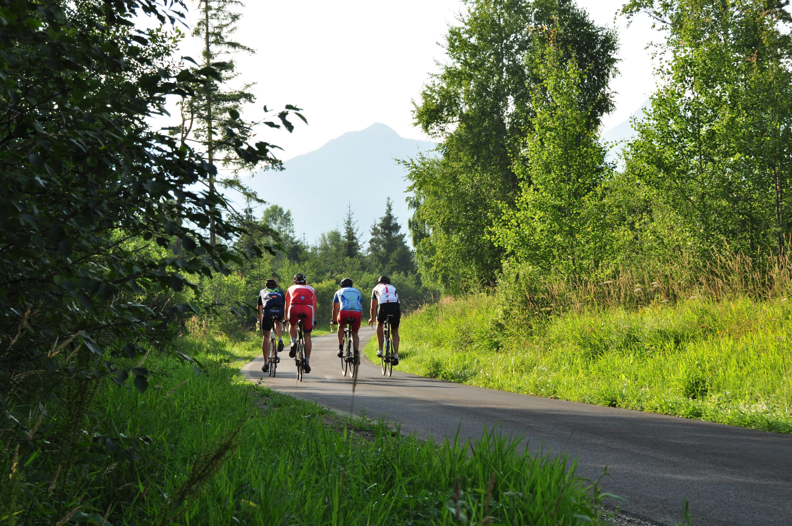
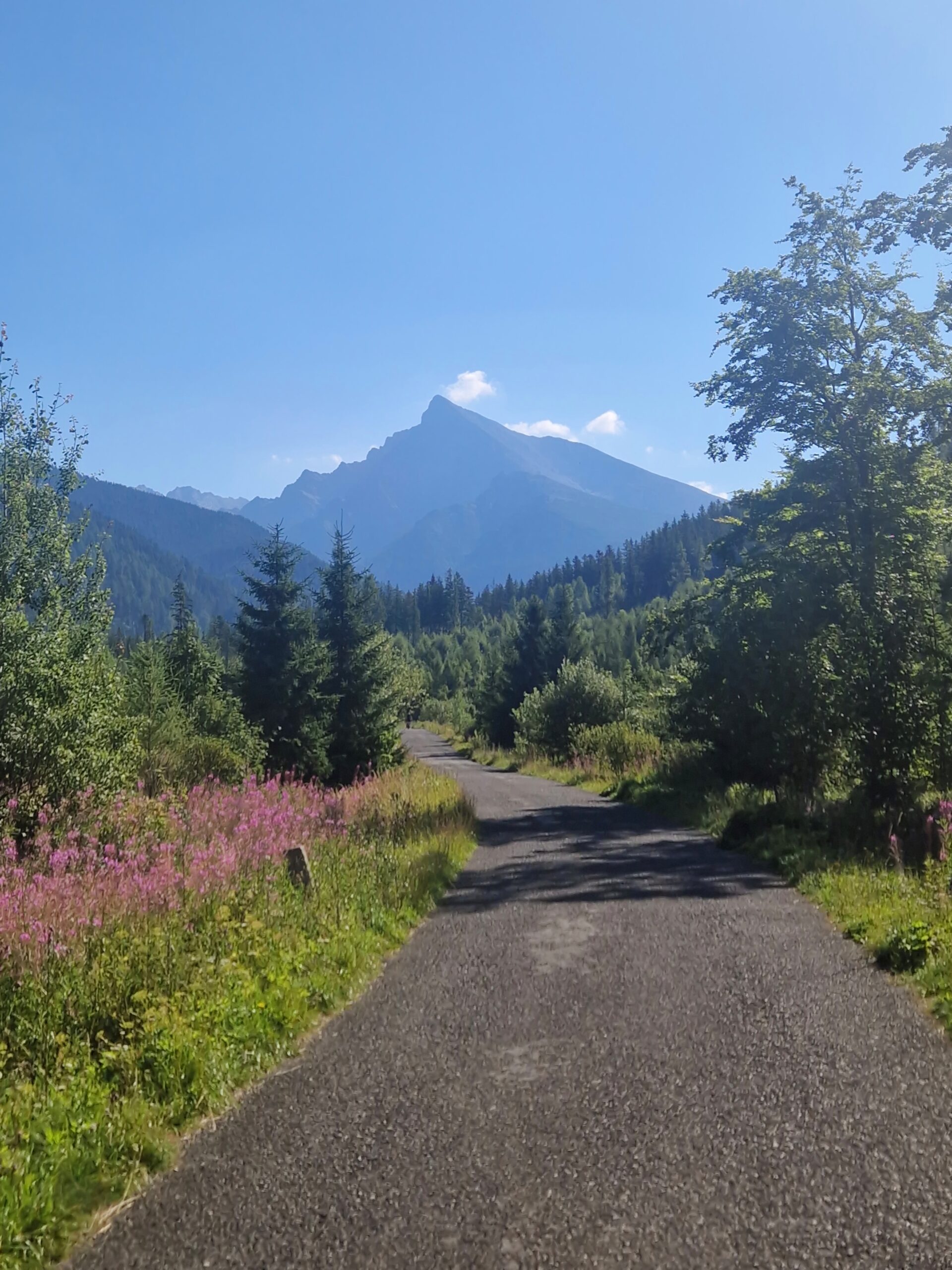
The bike trail leads from Podbanské through peaceful countryside between the Kriváň massif and the peaks of the Western Tatras. The initial paved road passes through the forest and climbs only slightly to the junction of the Tichá and Kôprová valleys, from where it continues to the right toward Kmeťov Waterfall.
Toward the end of the route, the paved road gives way to a gravel surface, which you can follow all the way to the shelter below Garajová Valley. A short, approximately five-minute detour on foot from the bike trail leads to Kmeť Waterfall, which is about 80 meters high.
Note
The final section is on gravel, so it is best suited for trekking or mountain bikes. You must continue on foot to Kmeť Waterfall.
What We Offer

Trasa a výškový profil
What do you need to know before you arrive?
Please read this before your visit
Approximately 7.8 km of the route follows a paved road. From the turnoff to Kmeť Waterfall, you can continue for about 1.5 km on a gravel road to the shelter below Garaj Valley.
There is no bike trail leading to the waterfall. You must park your bike at the turnoff and continue on foot for about five minutes.
You can handle the paved section on a road bike, but a trekking bike is better suited for the entire route, as it can handle the gravel surface at the end.
More than 9 kilometers through a peaceful valley below Kriváň
Bike Trail 2867 runs from Podbanské to the Kôprová Valley, which stretches between the Kriváň massif and the peaks of the Western Tatras. Its gentle terrain, forest setting, and mild incline make it a pleasant outing for families, recreational cyclists, and seniors alike.
The route continues along an asphalt road past the junction for Tichá and Kôprová Valley. After turning right, it leads through Kôprová Valley to Kmeť’s Waterfall and can then continue on a gravel path all the way to the foot of Garajová Valley.
A Peaceful Ride Through the Valley
The initial section runs through a forested area without any significant inclines. The trail begins to rise slightly just past the junction of Tichá and Kôprová valleys, while remaining technically undemanding.
Kmeť Waterfall
At the end of the paved section, there is a turnoff to Kmeť Waterfall, which is approximately 80 meters high. It is about a five-minute walk from the bike trail and makes for an attractive addition to the trip.

Tak to u nás vyzerá. Pozrite sa

Explore the region on two wheels
The Tatra Mountains offer an extensive network of bike trails for every type of cyclist—from easy trails in the foothills to challenging mountain loops with views that make every strenuous pedal stroke worthwhile.




Must-See Places. Discover them one by one
Every corner of the High Tatras has its own story. Discover the places that shape the character of the region.








The Tatra Mountains wake up differently every day
Current conditions, upcoming events, and editorial recommendations. Everything you need to know before heading to the Tatras.

Webcams
Poprad
-3°C
Clear

Lomnický štít
-10°C
Clear
Tatranská Lomnica
-2°C
Mostly clear

Starý Smokovec
0°C
Clear
Hrebienok
-1°C
Clear
Štrbské Pleso
0°C
Clear
Skalnaté pleso
-2°C
Mostly clear
Solisko
-3°C
Clear


Everything You Need to Know Before Your Trip
Answers to the most frequently asked questions about the High Tatras region.
