

007 – Podtatranská Cycling Route
The longest bike trail in the region



Length of the main route
Difficulty Level of the Bicycle Highway
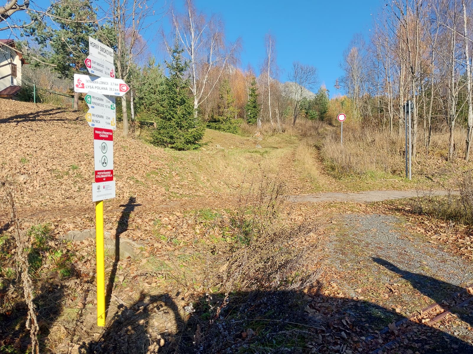
Signage along the Freedom Trail
It will take you through the entire region at the foot of the Tatra Mountains, from the west all the way to the Polish border
The Podtatranská Magistrála 007 runs from Podbanské through the main Tatra settlements to Tatranská Javorina and the Lysá Poľana border crossing. After an initial climb to Štrbské Pleso, it continues through Vyšné Hágy, Tatranská Polianka, Starý Smokovec, Tatranská Lomnica, and Tatranská Kotlina.
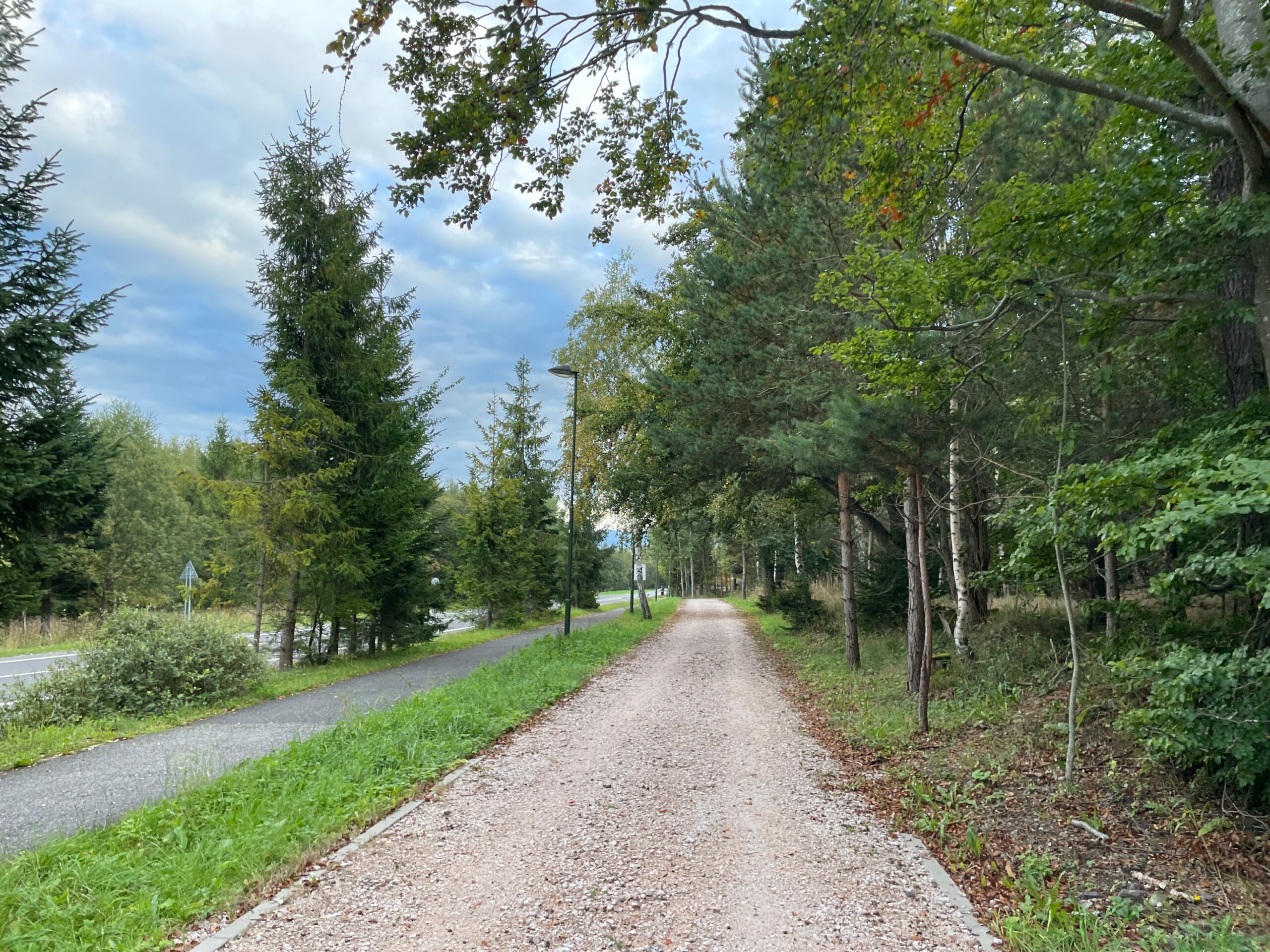
Most of the route follows the well-maintained asphalt surface of the Road of Freedom, offering panoramic views of the High Tatras. You can take a break at rest areas or in restaurants and cafés in the various villages. The final section climbs through Ždiar to Lysá Poľana, where the route connects to cycling trails in Poland.
Note
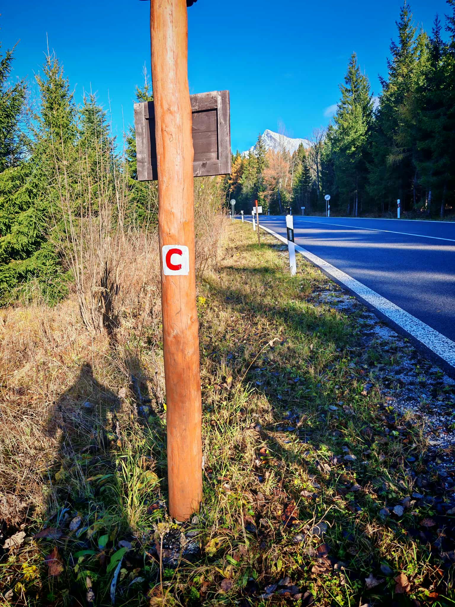
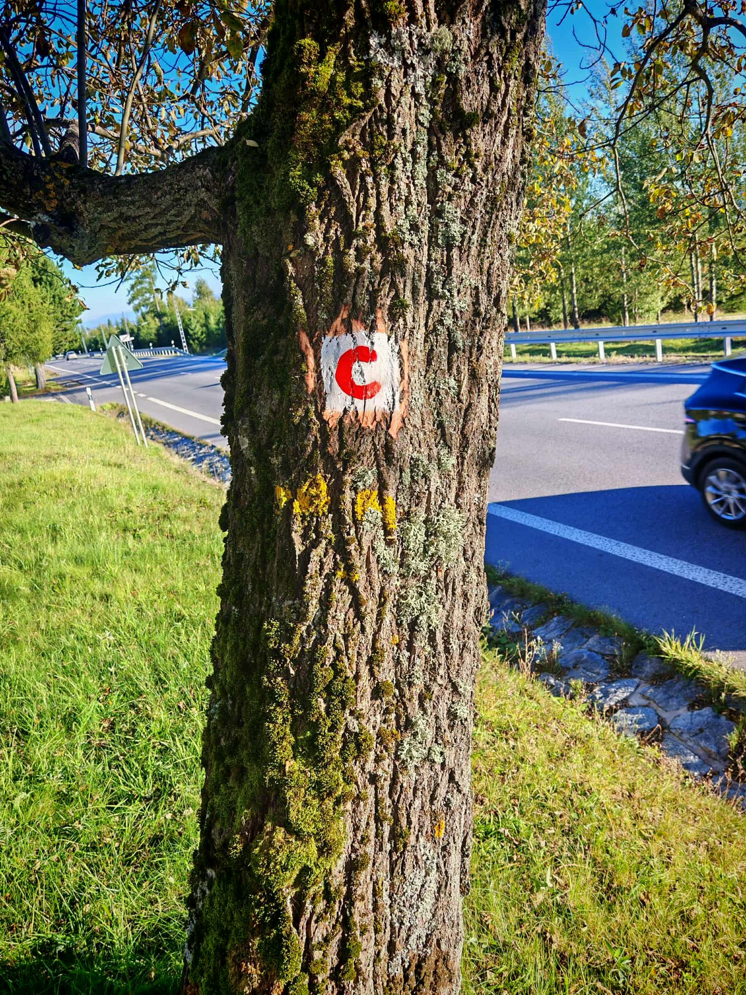
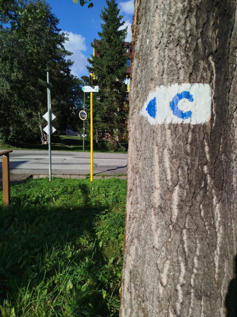
Some sections overlap with hiking trails, so please ride considerately and adjust your speed to accommodate other visitors. You may also encounter a black “C” on a white background along the route, which indicates sections permitted for cyclists according to the TANAP visitor regulations.
What We Offer

Trasa a výškový profil
What do you need to know before you arrive?
Please read this before your visit
Before you leave, check the current traffic conditions on each section of the route. There may be temporary restrictions along the route due to weather, maintenance, or activity within the TANAP area.
The entire route is 77.8 km long and includes two significant climbs—from Podbanské to Štrbské Pleso and from Tatranská Kotlina through Ždiar. We recommend that less experienced cyclists choose a shorter section.
The route is mostly marked with a red "C." On certain sections, you'll see a black "C" on a white background, and the route may run near sidewalks. Ride carefully and adjust your speed to the conditions.
Nearly 78 kilometers across the entire High Tatras
The Podtatranská Cycle Route 007 is one of the best-known and longest cycling routes in the High Tatras region. It runs from Podbanské through the main Tatra settlements and tourist centers all the way to the Lysá Poľana border crossing, where it connects to cycling routes in Poland.
The route begins with a long climb to Štrbské Pleso and then continues on a mostly downhill course through Vyšné Hágy, Tatranská Polianka, Starý Smokovec, and Tatranská Lomnica to Tatranská Kotlina. The final section climbs again through Ždiar to Tatranská Javorina and the Polish border.
Area and Views
Most of the route consists of the high-quality asphalt surface of Cesta slobody. As you drive, panoramic views of the Tatra peaks and the surrounding foothills unfold before you. On the stretch between Štrbské Pleso and Starý Smokovec, you can take advantage of the rest areas along the road.
Route Markings
The route is marked with a red “C” symbol along the Freedom Trail. In some places, you may also see a black “C” on a white background. These are sections where cycling is permitted under the Tatra National Park visitor regulations, but they do not have an assigned registration number.
Sections marked in black
– VM14 – Nový Smokovec – Vyšné Hágy / 10.1 km
– VM15 – Vyšné Hágy – Popradské Pleso / 4.1 km
– VM17 – Štrbské Pleso – Kolečková / 6.6 km
Pedestrians may also be present on certain sections of the road. Therefore, please drive carefully, maintain a safe distance, and adjust your speed to the current conditions.

Tak to u nás vyzerá. Pozrite sa
Explore the region on two wheels
The Tatra Mountains offer an extensive network of bike trails for every type of cyclist—from easy trails in the foothills to challenging mountain loops with views that make every strenuous pedal stroke worthwhile.




Must-See Places. Discover them one by one
Every corner of the High Tatras has its own story. Discover the places that shape the character of the region.








The Tatra Mountains wake up differently every day
Current conditions, upcoming events, and editorial recommendations. Everything you need to know before heading to the Tatras.

Webcams
Poprad
-3°C
Clear

Lomnický štít
-12°C
Clear
Tatranská Lomnica
-4°C
Clear
Starý Smokovec
-2°C
Clear
Hrebienok
-3°C
Clear
Štrbské Pleso
-2°C
Clear
Skalnaté pleso
-2°C
Clear
Solisko
-2°C
Clear


Everything You Need to Know Before Your Trip
Answers to the most frequently asked questions about the High Tatras region.
