

From Podbanské to Kmeť’s Waterfall
Podbanské – Kmeť Waterfall



The Height of Kmeť Waterfall—the Highest in Slovakia
Total length of the route (round trip from Podbanské)
Estimated walking time
A leisurely hike through the Kôprová Valley leads to a majestic waterfall hidden in the shadow of Kriváň
The hike from Podbanské to Kmeťov Waterfall is one of the most beautiful and least technically demanding trails in the western part of the High Tatras. It leads through the picturesque Kôprová Valley along a paved asphalt and forest road, lined by the Kôprovský Stream. Thanks to its gentle incline and paved surface, the trail is extremely popular with families with children, recreational hikers, and cyclists.
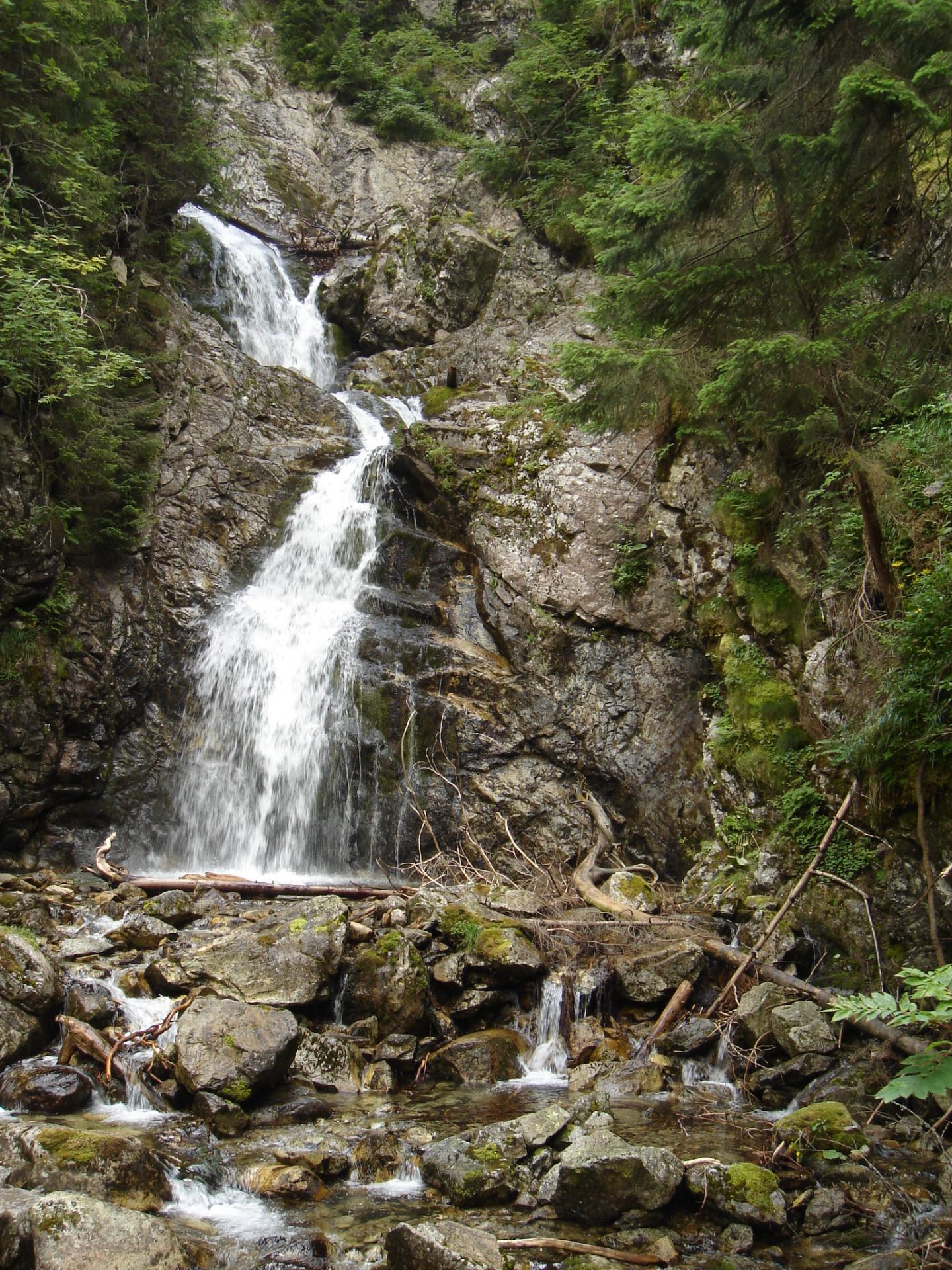
The destination of the hike is Kmeťov Waterfall on the Nefcerský Stream, which, at a height of approximately 80 meters, is considered the highest waterfall in all of Slovakia. From the trail junction below Grúnik, a short detour along a forest path leads to a wooden observation deck, offering an impressive view of the roaring cascades plunging between rocks and trees.

What We Offer

Trasa a výškový profil
What do you need to know before you arrive?
Please read this before your visit
The route follows the blue and yellow hiking trails from Podbanské. The elevation gain is minimal (approximately 280 meters spread over 7 km one way). The entire section through the valley is easy and straightforward; the only slightly more challenging part is the short hike up a forest trail from the fork in the trail to the lookout point.
Kmeťov Waterfall is located at the mouth of the Nefcerka Valley, which is a strictly protected national nature reserve with the highest level of protection. Venturing outside the marked hiking trail and viewing platform is strictly prohibited.
Kôprová Valley is a great choice for a bike ride. You can easily ride your bike all the way to the fork in the road below Grúnik (where you can leave your bike) and from there continue on foot to the lookout point—it’s about a 5- to 10-minute walk.
A leisurely ride with a gentle incline and a paved surface
The route follows mostly an easy, paved forest road with a very gentle, gradual ascent through the Kôprová Valley. From Podbanské (from the fork near the Permon Hotel), the route begins along the blue trail marker, following the course of the Kôprovský Stream. After an easy stretch, it passes through the Rázcestie pod Grúnikom junction and from there continues along a forest trail directly to the observation deck below Kmeť Waterfall.
The elevation difference between Podbanské and Kmeť Waterfall is approximately 305 meters spread over a 7-kilometer one-way route. The trail does not include exposed sections, chains, or challenging rocky terrain. Most of the trail is also suitable for mountain bikes and strollers; the final short section consists of a forest trail with rocks and tree roots.
Trail Markings
Blue trail
Podbanské – Ústie Kôprovej doliny – Nad Bytom – Rázcestie pod Grúnikom
Yellow / Educational Trail Branch
, Crossroads below Grúnik – Kmeť Waterfall (viewpoint)
Landmarks along the route
Podbanské (crossroads) – approximately 940 m above sea level
Mouth of the Kôprová Valley – 955 m above sea level
Nad Bytom (bridge over the Kôprovský Stream) – 995 m above sea level
Crossroads below Grúnik – approximately 1,120 m above sea level
Kmeť Waterfall (viewing platform) – approximately 1,245 m above sea level

Tak to u nás vyzerá. Pozrite sa
Other tourist activities with children
Didn't find what you're looking for? Explore other family-friendly trails, nature trails, and hidden natural gems in the High Tatras that you can easily enjoy even with the youngest children.


Must-See Places. Discover them one by one
Every corner of the High Tatras has its own story. Discover the places that shape the character of the region.









Webkamery
Poprad
-1°C
Jasno

Lomnický štít
-9°C
Prevažne jasno

Tatranská Lomnica
-1°C
Prevažne jasno
Starý Smokovec
0°C
Prevažne jasno
Hrebienok
-1°C
Prevažne jasno
Štrbské Pleso
1°C
Jasno
Skalnaté pleso
0°C
Prevažne jasno
Solisko
0°C
Jasno


Všetko, čo potrebujete vedieť pred výletom
Odpovede na najčastejšie otázky o regióne Vysoké Tatry.
